


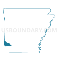
Jewell Voting District, Little River County, Arkansas
About
Outline

Summary
| Unique Area Identifier | 527117 |
| Name | Jewell Voting District |
| County | Little River County |
| State | Arkansas |
| Area (square miles) | 17.51 |
| Land Area (square miles) | 17.51 |
| Water Area (square miles) | 0.00 |
| % of Land Area | 100.00 |
| % of Water Area | 0.00 |
| Latitude of the Internal Point | 33.85378920 |
| Longtitude of the Internal Point | -94.42495300 |
Maps


Graphs
Select a template below for downloading or customizing gragh for Jewell Voting District, Little River County, Arkansas


Neighbors
Neighoring Voting District (by Name) Neighboring Voting District on the Map
- Voting District 13, McCurtain County, OK
- Voting District 15, McCurtain County, OK
- Arkinda Voting District, Little River County, AR
- Caney Voting District, Little River County, AR
- Little River Voting District, Little River County, AR
Top 10 Neighboring County Subdivision (by Population) Neighboring County Subdivision on the Map
- Southeast McCurtain CCD, McCurtain County, OK (2,724)
- Little River township, Little River County, AR (400)
- Caney township, Little River County, AR (314)
- Jeff Davis township, Little River County, AR (269)
- Jewell township, Little River County, AR (200)
- Arkinda township, Little River County, AR (75)
Top 10 Neighboring Unified School District (by Population) Neighboring Unified School District on the Map
- Horatio School District, AR (4,045)
- Foreman School District, AR (2,782)
- Haworth Public Schools, OK (2,725)